GettyImages/justinstokes
Storm Research: Studying the Role of Extreme Weather in Our Planet's Climate
Storms seem to be getting bigger and badder every year. The national severe storm laboratory studies hurricanes, tornadoes, wildfires and more to improve scientific understanding about extreme weather.
Storm research plays a vital part in mapping the world's weather systems and climate. So the US National Severe Storms Laboratory (NSSL) studies a vast range of severe weather phenomenon – including hurricanes, tornadoes, blizzards, floods, droughts, and wildfires – to improve scientific understanding.
Every day there are as many as 40,000 thunderstorms around the world and this makes it one of the NSSL's central areas of study. Severe storms cause widespread property damage and regularly lead to loss of life, so meteorologists gather data on their formation to improve our warning systems.
The National Oceanic and Atmospheric Administration (NOAA) Hazardous Weather Testbed is a joint project of the NSSL and the National Weather Service (NWS). The NOAA HWT experimental forecast program focuses on computer models to improve prediction of severe weather events up to a week in advance. While its experimental warning program tests and evaluates new techniques, technologies, and observing platforms to improve weather warnings.
Backing this up is the NOAA Storm Prediction Center, which provides a real-time US storm map along with forecast tools, a tornado-watch map and historical data on severe weather climatology.

GettyImages/Ryan McGinnis
Tornadoes
Tornadoes are among the most destructive storm phenomena and they tend to emerge from perhaps the most violent thunderstorms, known as supercells. Rapidly rotating supercell storms unleash the fastest surface winds on Earth – up to 200 miles per hour. Supercells are prevalent across the central US during spring and can rise 10 miles high, containing vast volumes of air up to 25 times the mass of Mount Everest.
The supercell is actually small compared to other thunderstorms, but ferocious. Sudden wind speed or directional changes (wind shear) and updrafts lead to tornado formation when cyclonic vertical wind columns touch the ground. There are around 1,200 tornadoes in the US every year. Supercell storms can also produce lightning and large hailstones, as big as baseballs.
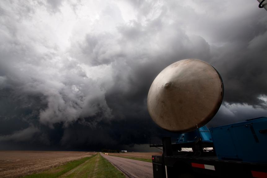
Research into supercell thunderstorms is a crucial part of the NSSL's Targeted Observations by Radar and UAS of Supercells (TORUS) project. More than 50 researchers and students gather data to understand the relationships between severe storms and tornadoes.
Around a dozen radar, balloon, drone, and ground observation teams travel into a storm, backed up by the NOAA's P-3 Hurricane Hunter plane flying just outside the storm, to gather as much information as they can.
Swarms of up to 100 radiosondes – small telemetry data instruments – are released attached to small weather balloons to measure variables including wind speed, direction, air pressure, altitude and humidity. By measuring small scale structural changes, TORUS will reveal more about how supercells create tornadoes.
Hurricanes (or Typhoons)
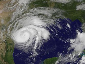
Also regularly on the NOAA's radar are larger tropical storms, typically about 300 miles wide, known as hurricanes or typhoons. Typhoon is the regional term for storms affecting countries in the northwestern Pacific basin like Japan, China and the Phillipines, while hurricane is used for the same storms in the northeast Pacific and northern Atlantic. These cyclonic storms are large air masses that rotate around a center of low atmospheric pressure producing sustained winds in excess of 74 miles per hour.
Hurricane season begins on June 1 and ends on November 30 each year in the Atlantic basin. There are an average of 12 of these massive storms each year. The ferocity of hurricanes is measured using the Saffir-Sampson Hurricane Wind Scale one to five rating. Category five hurricanes have maximum sustained wind speeds of more than 157 mph that can devastate housing, leaving an area uninhabitable for weeks or months.
More on Storms
The Science Behind Hurricanes
Hurricane season is back. Here’s what you need to know about these violent storms.
5 of the Weirdest Types of Lightning
Some types of lightning are also deadlier than others. Here are some of the rarest, weirdest, and scariest forms of lightning out there.
More Storms
Other storm systems that the NSSL studies in detail include Mesoscale Convective Systems (MCS), squall lines and derechos. These are types of thunderstorm clusters that produce destructive straight-line winds rather than rotational wind. The MCS are common in many parts of the world, including the central and southern US, southeast Asia, sub-Saharan Africa and northern Australia.
They typically produce flash flooding and high lightning rates besides damaging wind speeds. One MCS cluster produced 6,076 cloud-to-ground lightning strikes in just 15 minutes over the Gulf Coast in 2014.
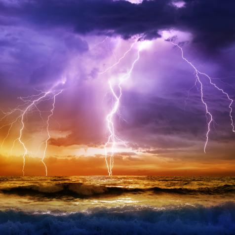
Thunderstorm electricity measurements are vital because they indicate a storm's severity. One single thundercloud can carry one billion volts of energy and a single lightning flash has an average discharge of 300 million volts, reaching temperatures in excess of 50,000 degrees fahrenheit.
The NSSL relies on a vast array of instruments to measure lightning. This includes geostationary satellites, balloon systems and ground sensors such as the Oklahoma Lightning Mapping Array. The mapping array has revealed 'lightning holes' in some supercell storms, just before they increase in severity, allowing forecasters to upgrade storm warnings.
The Power of Lightning
Global experiments show the immense elemental power of lightning bolts. In Corsica, Italy, the French multi-agency EXAEDRE project operates a chaser plane to study lightning from inside storms. Its Falcon 20 jet is a fully equipped flying laboratory with a range of monitoring equipment to record storm activity.
Instruments measure lightning activity, cloud composition, particle dynamics, wind readings and high energy particles. The aim is to learn more about the conditions that lead to lightning bolts being released and different formations. Additional ground observations include radar readouts, a lightning antennae network and laser arrays that help the team to read atmospheric conditions more accurately.
Twelve antennae give precise times of lightning strikes and record electric peaks to map the storm's evolution. The entire storm can then be recreated using 3D computer graphics. The overall aim of EXAEDRE is to discover how lightning data can predict climate evolution. Its researchers predict that we can expect fewer but more intense storms as the world's climate grows warmer.


