seanscott
NASA is Helping Save Sharks
As the battle to save species across the world wages on, conservation efforts are becoming more and more technological in tracking, monitoring and collecting data.
And perhaps one of the most advanced techniques is currently being deployed by NASA, an unlikely ally in the fight to save sharks.
While scientists at other government agencies like NOAA and Marine Mammal Commission are focusing directly on shark conservation, NASA is lending a helping hand from far above the earth in a lot of ways…
Tracking movement
NASA satellite data, combined with field measurements, help scientists construct a picture of the travel routes of sharks, as well as other marine animals. In 2019, NASA partnered with France’s space agency, the Centre National D'Etudes Spatiales, and used the Cloud-Aerosol Lidar and Infrared Pathfinder Satellite to observe the huge animal migration that happens every night under the cover of darkness.
Innumerable small sea creatures–from squid to krill–swim from the ocean depths to near the surface to feed, and this migration, which is the largest on earth and a critical part of the marine ecosystem, is all captured by a space laser.
This migration provides information about the food supply that is available to sharks, and how changes in the ecosystem could impact the health of sharks.
Ocean productivity
A system called EXport Processes in the Ocean from Remote Sensing (Exports) is taking a look at the ocean’s biological pump. The pump is a natural process which involves carbon from the atmosphere–and the surface of the ocean–is sequestered in the deep ocean. The whole process starts when phytoplankton draw carbon out of the atmosphere through photosynthesis. This starts the entire marine food chain, because phytoplankton turn atmospheric carbon into food when they are eaten by tiny animals called zooplankton. These are eaten by fish who are in turn eaten by bigger fish and large marine animals, including sharks. When fish and marine animals die, they carry the carbon stored in their bodies to the ocean floor.

Cavan Images
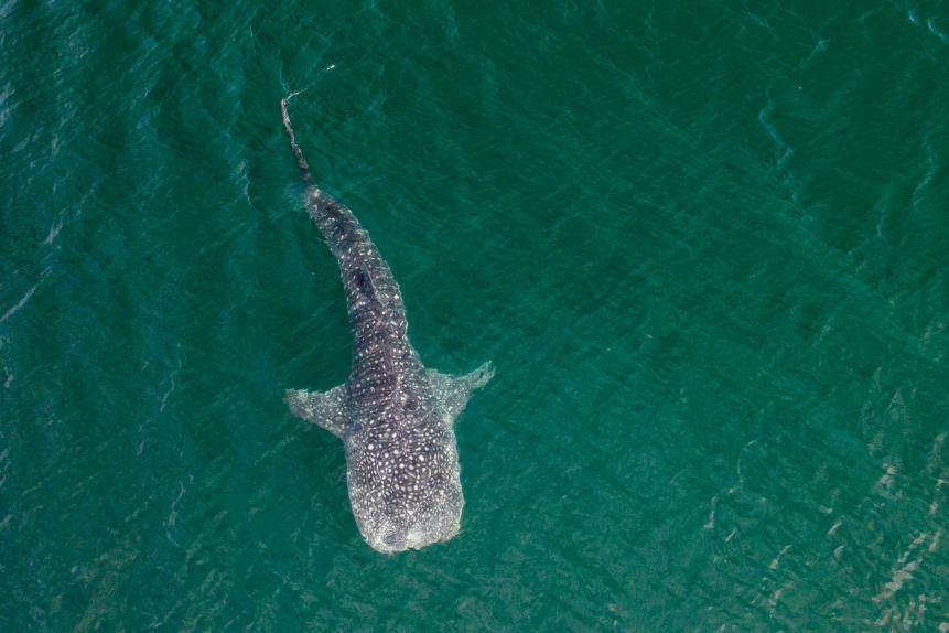
Researchers can identify whale sharks by the unique pattern of their spots.
From the stars to the sea
In 1986, a Princeton University researcher developed an algorithm to map the stars that were captured by the Hubble Telescope. Now, however, that same algorithm has been adapted to recognize the star-like patterns on speckle-skinned 40 foot-long whale sharks. This allows researchers to identify individual whale sharks, as each animal has its own unique pattern, and aids them to keep tabs on the sharks.
Weather patterns
Changes in sea levels as well as storm severity and other climate patterns such as La Niña and El Niño impact sharks. NASA has been measuring the height of the ocean for almost three decades, using satellites that can detect changes in height within an inch, giving extremely precise sea level measurements. This is useful to understand the impact of ocean changes on marine animals. Sea surface height is also used in cleaning up marine oil spills, sustainably managing fisheries and understanding the behavior of ocean animals. The measurements are also used to derive ocean surface currents and ocean eddies–circular currents of water–that continuously stir and mix the water, which again impacts the behavior and migration patterns of sharks as they change the ocean’s biogeochemistry, essentially how minerals and nutrients flow through the water.

Roberto Machado Noa
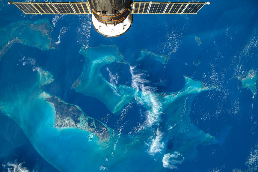
Image from ISS over the Atlantic Ocean.
New Frontiers
If the above projects weren’t enough, NASA has three new missions planned in ocean study. Launching in 2022, the Surface Water and Ocean Topography mission will measure small-scale ocean currents and swirling eddies to better understand the mixing and transport of water and nutrients, as well as the dispersal of pollution into the ocean. Sharks are highly sensitive species and are impacted greatly by ocean pollution, such as microplastics.
Another project will use “ocean color” technology to learn more about phytoplankton, a keystone species that impacts the entire marine food chain, that live in the upper ocean.
Finally, an instrument that will observe ocean biology, chemistry and ecology will provide scientists with unique information about the Gulf of Mexico, portions of the southeastern United States coastline, and the mouth of the Amazon River where it enters the Atlantic Ocean. And the more scientists know about sharks and their habits, the better prepared they can be to help save them.


