darekm101
5 of America's Most Extreme Destinations
America is a big place and a nation of some pretty major extremes. Between its highest and lowest points is a full 20,592 feet (6,276 meters): You could stack 11.5 One World Trade Center buildings at the bottom of Badwater Basin and only barely reach the top of Denali. From the coldest nights to the hottest days is a difference of more than 200 degrees Fahrenheit (93 degrees Celsius). Some corners of the country see more than 30 feet (9 meters) of rain or snow, while others are lucky to see an inch in the same year. Seeing both ends of the spectrum is one of the best ways to really understand everything the country has to offer, and luckily, there are hikes and adventures that can help you see every corner of the country in its truest form.

GettyImages/pkujiahe
Highest: Denali, Alaska
At 20,310 feet (6,190 meters), Denali soars almost 6,000 feet (1,800 meters) over any peak in the lower 48. But when you combine its elevation with its northern latitude, it becomes one of the most extreme peaks not only in the U.S., but in the world. Renowned for its cold, high winds, massive avalanches, gigantic crevasses, and an assortment of other life-ending features, Denali is a sought-after objective for mountaineers the world over.
Thankfully, there are other ways to enjoy the roof of the continent, including for climbing mortals. From Denali National Park and Preserve's Eielson Visitors Center, at mile 66 on the Park Road, hike only 0.8 miles (1.3 kilometers) up a steep hillside and crest a ridge with views south to the gravely, green flats of Thorofare Gorge and beyond to the snowcapped peaks of the Alaska Range. If you're lucky (only one-third of Park visitors are), you'll have a straight shot to Denali itself.

GettyImages/KiskaMedia
Lowest/Hottest/Driest: Death Valley, California
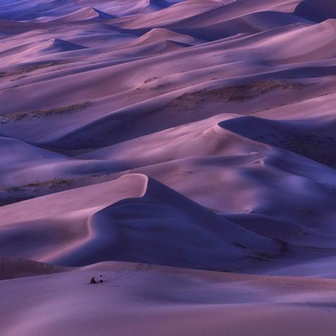
At 282 feet (86 meters) below sea level, Death Valley is the lowest place in North America. It's also one of the harshest environments in the country, if not the world. While Badwater Basin is the continent's lowest point, the aptly-named Furnace Creek holds the record for the highest recorded air temperature on Earth, at a staggering 134 degrees Fahrenheit (56.7 degrees Celsius). Less than 100 miles to the west, the lower-48's highest point sits in the rest of the Sierra Nevada mountain range, which acts as a rain shield. As a result, the valley sees remarkable little precipitation — barely 2 inches (5 centimeters) per year, on average, some years not seeing any rain at all.
Nevertheless, when the weather is manageable, Death Valley is one of the most spectacular places to hike. Cross Badwater Basin on a 6.2-mile (10-kilometer) one-way trail and weave through mineralized sand dried into plates and crusted salt flats with views of the peaks surrounding the basin.

Charles D. Evans
Coldest: Prospect Creek, Alaska
What does it feel like when it's almost minus 80 degrees Fahrenheit (minus 62 degrees Celsius)? Residents of Prospect Creek might be the only Americans who know. The former mining town and camp during the building of the Trans-Alaska Pipeline saw the record-low temperature on January 23, 1971.
A few hours south, Fairbanks faces similar cold and is one of the country's chilliest cities. Put a jacket on and hike the Granite Tors Trail just outside of town. You can march across alpine tundra and large glacial rock remnants known as "tors" on the 15-mile (24-kilometer) loop.

GettyImages/maximkabb
Wettest: Mt. Waialeale, Hawaii
Waialeale translates to "dripping water" or "overflowing water." The name makes perfect sense for the second highest peak on Kauai, which averages more than 38 feet (460 inches) of rain every year. The peak's northerly exposure, conical shape, and elevation are all thought to factor into its immense rainfall, but most important are its tall cliffs, which force wet air to rise nearly 3,000 feet (900 meters) in a half mile (0.8 kilometers), dropping a lot of moisture immediately.
The world-famous Kalalau Trail travels the Na'Pali on Kauai's wet northwestern shore, perfect for exploring the rainforests, waterfalls, and wildlife fed by Waialeale's nonstop rain. Spend a few days exploring the 19.1-mile (30.7-kilometer) point-to-point.

GettyImages/cestes001
Snowiest: Paradise Ranger Station, Mount Rainier National Park, Washington
If you could get up to the Paradise Visitors Center on Mount Rainier in March of 1955, you would have been driving through a canyon. That year, the spot racked up a massive 30-foot (9-meter) snowpack. Seeing the large visitors center building buried in drifts is not uncommon due to the 14,000-foot (4,400-meter) peak's proximity to the ocean and its stand-out nature. It's these same reasons that make the peak the most heavily glaciated mountain in the lower 48.
Get one of the best non-technical views of the mountain by climbing 3.3 miles (5.3 kilometers) up Pinnacle Peak. From the rocky summit, you'll get views down onto Paradise, as well as the massive glaciers flowing down from the mountain's snowy summit.
This article first appeared on Curiosity.com.


